Eastern Po Valley and Po Delta.

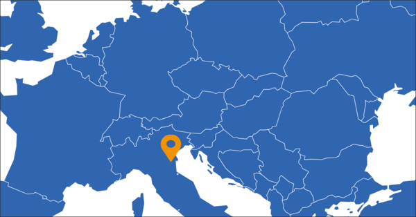
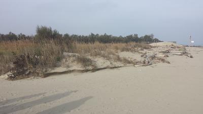
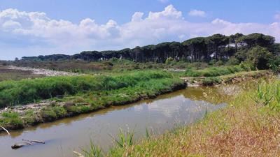
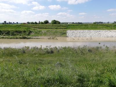
Both the Italian frontrunning and replicating regions extend from the Panaro River in the eastern part of the Emilia-Romagna region (Italy) to the coast of the Adriatic Sea within an area of 3000 km2. Nestled within the eastern sector of the Po Valley, this region has an almost flat terrain. The focus of developmental initiatives is centred on the Panaro River's riverbanks, which demarcate fertile agricultural fields in the heartland and extend to a natural reserve along the coastal periphery. Despite its coastal location, the climate in this region leans towards the subcontinental, marked by warm and humid summers contrasting with cold winters. This climatic variance significantly influences the local vegetation, resulting in a landscape reminiscent of central and eastern Europe within the flat inland areas. The coastal section, particularly the Po Delta, stands out for its unique features, where saline wetlands gracefully transition into sandy expanses with low water retention capabilities.
Challenges facing the region.
Eastern Po Valley and Po Delta region struggles with a dual challenge as both its river and coastal areas confront persistent flooding and drought. The delicate natural reserve ecosystem is under constant threat from salt intrusion, storm surge, and coastal erosion. These threats not only contribute to biodiversity loss but also pose a risk to both natural and artificial infrastructures, jeopardising the delicate balance of the region.
LAND4CLIMATE related actions and expected results.

There are three main action points within LAND4CLIMATE in the Eastern Po Valley and Po Delta. Firstly, at the Panaro River, the strategic plantation of herbaceous deep-rooted plants along the riverbanks. This intervention aims to fortify the river's defences, acting as a preventive measure against levee failures and catastrophic flooding. At the coastal areas, the project introduces two distinct interventions. Onshore, the construction of an artificial sand dune crafted from natural biodegradable materials. This approach seeks to mitigate coastal erosion and salt-wedge intrusion by absorbing wave energy and diminishing the intrusion of sea salt into the river's freshwaters. Offshore, the plantation of halophytic plants along the coast. This intervention is a strategic measure to further mitigate coastal erosion and flooding. The halophytic plants contribute to the establishment of an engineered (green) dune, capable of supporting sand removal and withstanding the impact of storm surges. The anticipated results of these interventions align with the specific hazards they target. For the Panaro River intervention, the goal is to prevent levee failures, averting the potential for catastrophic inundations triggered by river flooding. On the coast, both onshore and offshore interventions aim to collectively mitigate coastal erosion, while the onshore artificial sand dune specifically addresses salt-wedge intrusion by reducing the sea salt's influence on river freshwaters. The engineered (green) dune serves a dual purpose by supporting sand removal and providing a resilient barrier against storm surges.
Replicating Region's role in LAND4CLIMATE.
In the context of LAND4CLIMATE, replicating regions play a crucial role as observers and learners, focusing on knowledge and experience exchange with their relative frontrunning region. This approach aims to replicate the success of these measures in a practical experiment, assessing their adaptability in a different regional context. The emphasis is on knowledge transfer and skill development through collaborative efforts with the partner region. To facilitate this knowledge exchange, replicating regions participate in training programs related to the NBS efforts of LAND4CLIMATE. In essence, the replicating regions serve as active participants in the scaling-up process, contributing to the broader goal of extending the reach and effectiveness of NBS initiatives. By fostering collaboration and learning from frontrunning regions, they enhance their capacity to address climate challenges and contribute to a sustainable and resilient future.


