On the Frontlines: Assessing Climate Vulnerability for NBS Implementation
Finding a good way to implement Nature-Based Solutions (NBS) on private land is one of the main objectives of LAND4CLIMATE. Next to that, knowing where the NBS is needed is highly relevant to make its implementation successful. This is why as part of the project we work on a climate risk assessment for all six front-running regions. The aim of this assessment is to identify the locations in each region, that are most affected by heavy rainfall, flooding, heat and drought – the so-called hotspots.
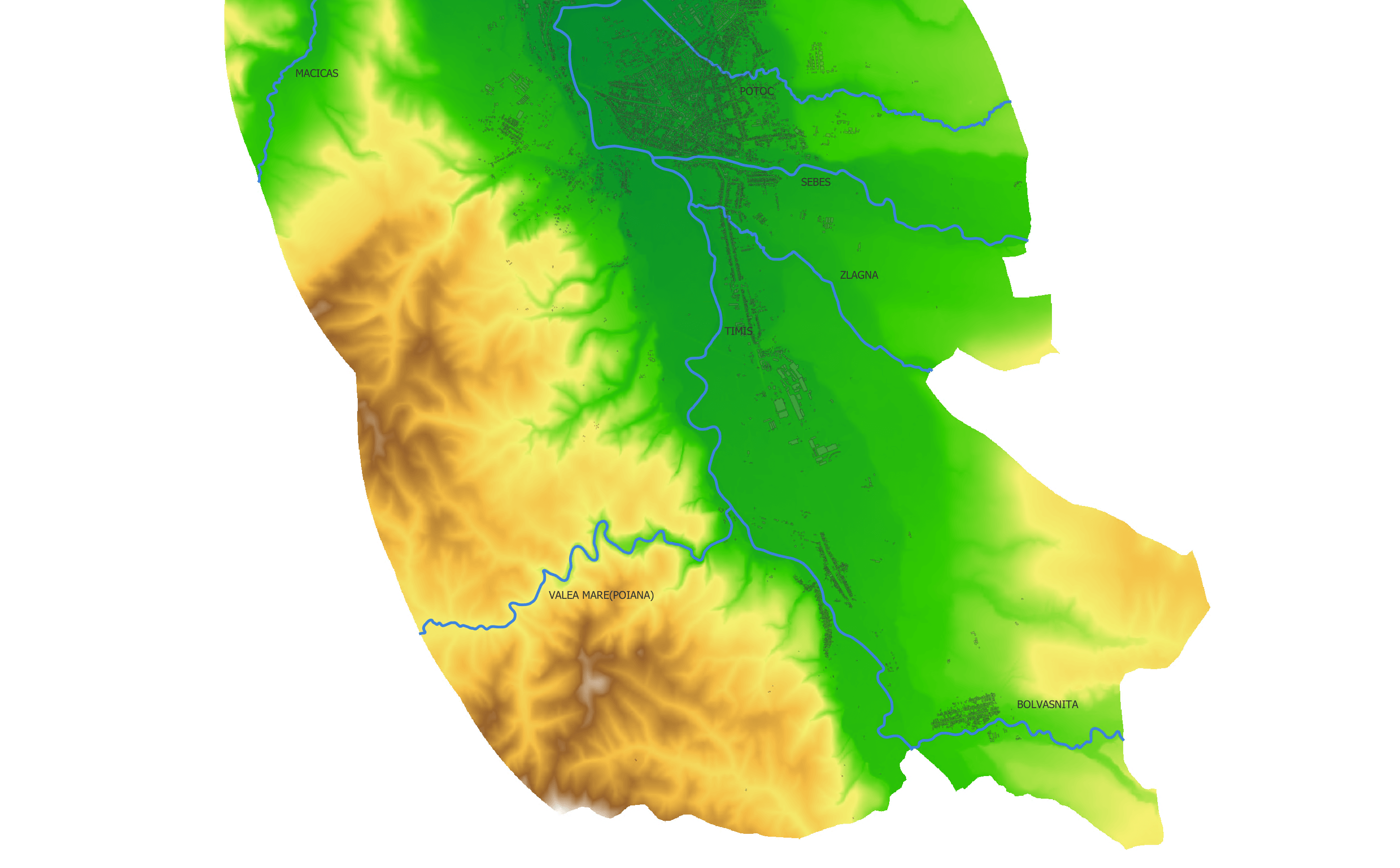
In this context, RWTH Aachen currently works on identifying the extent of heavy rain and flooding in each region. The first region which the team is currently building a numerical model for to investigate the extent of heavy rainfall is Upper Timiş River catchment in Romania. Based on the digital terrain model, historical rainfall data, land-use information and building shapes, the water depths and flow velocities will be calculated for the whole front-running region for current and future scenarios.
With this new information, we aim to create a valid basis for selecting the most effective NBS in the front-running region as well as also support replication of knowledge-driven NBS implementation in other regions. When the work progresses, we are excited to share more information about the results of the climate risk assessment within LAND4CLIMATE.
Publishing date: